
Cyclone Yaas May Intensify Into "Very Severe Cyclonic Storm", Cross Odisha, Bengal
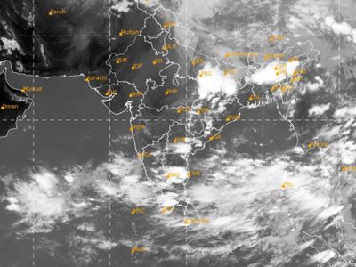
A low-pressure area formed over east-central Bay of Bengal today, which is likely to intensify into a very severe cyclonic storm and move towards West Bengal, adjoining north Odisha and Bangladesh coasts around May 26 morning, the regional met department said.
The system is very likely to cross the coasts of the two states and the neighbouring country on May 26 evening, said Regional Meteorological Centre (RMC) Director GK Das.
Wind speed is expected to reach 90-100 km per hour gusting to 110 kmph from May 26 forenoon along and off West Bengal, north Odisha and Bangladesh coasts, and increase thereafter till evening, he said.
"The low pressure area is very likely to concentrate into a depression over eastcentral Bay of Bengal by tomorrow, the 23rd May morning. It is very likely to move north-northwestwards, intensify into a Cyclonic Storm by 24th May and further into a very severe cyclonic storm during the subsequent 24 hours," the India Meteorological Department told news agency Press Trust of India.
The Indian Navy has kept on standby ships and aircraft to render assistance in the most-affected areas, a Defence spokesperson said.
Mr Das said light to moderate rainfall at most places of Gangetic West Bengal with heavy rain at isolated places is very likely to commence over coastal districts from May 25 with significant increase in intensity and area subsequently.
"Light to moderate rainfall at most places with heavy to very heavy rainfall at a few places, and extremely heavy rainfall at isolated places very likely on May 26," he said.
Owing to the weather system, sub-Himalayan West Bengal and Sikkim are also expected to experience light to moderate rain at most places with heavy to very heavy rainfall at isolated places on May 26.
Very heavy rainfall is forecast for a few areas on May 27, Mr Das said.
The impact of the developing cyclone will be evident along and off West Bengal, north Odisha and Bangladesh coasts from May 24 evening with wind speed reaching 40 to 50 kmph gusting to 60 kmph, the Met Department said.
Sea condition will be high to very high over major parts of central Bay of Bengal and Odisha, West Bengal and Bangladesh coasts from May 24 to May 26, it said.
Fishermen have been advised not to venture into the sea from May 23 till further information.
Four naval ships are on standby with humanitarian assistance and disaster relief, diving and medical teams, the spokesperson added.
"Eight flood relief teams and four diving teams are prepositioned at Odisha and West Bengal to augment the existing resources," the official said.
Aircraft have been kept ready at naval air stations INS Dega in Visakhapatnam and INS Rajali near Chennai to undertake aerial survey, casualty evacuation and airdrop of relief material as required, the spokesperson said.

Big News

Kerala floods: At least 26 killed as rescuers step up efforts
- Kerala floods: At least 26 killed as rescuers step up efforts
- Farm laws: India PM Narendra Modi repeals controversial reforms
- Kerala: A mother's search for her missing baby in India
- सलमान के घर फायरिंग: पुलिस को बड़ी सफलता, CCTV में दिखे शूटर्स, बाइक बरामद, सामने आया इस गैंगस्टर का नाम
- Actor Aamir Khan files FIR against deep fake video showing him promoting Congress🔥🔥
- India election 2024 phase 1: Who votes and what’s at stake?


Comments